Friday, July 31, 2015

Denali National Park - Part 2

The Denali National Park and Preserve represent the unique flavor of Alaska.  From a low spot within the park of 200 feet, the mountain rises to 20,320 feet in one grand vertical sweep.  Not only is it the highest mountain in North America, Mount McKinley is considered to be the most spectacular rise of any single mountain on earth.

The mountain was first called Denali, the “High One,” by the Indian Nation many years ago.  In 1897 the mountain was named Mount McKinley for President William McKinley.  The park was called McKinley National Park until 1980 when the name was changed to Denali National Park.  At that time, the park was tripled in size to six million acres.


Denali National Park is accessible by the Parks Highway or the Alaska Railroad from either Anchorage or Fairbanks.  In summer a number of private bus and van services operate daily from these cities.  We took a shuttle bus tour of the park.  One could get off or on a shuttle as desired.  People would get off to hike up a trail and then take the next shuttle. 
Don’t be fooled by the word “Highway.”  Sure, it was a paved road for maybe ½ mile.  Then the road changed to dirt, and then the road narrowed to about 1½ lanes and it was two-way traffic. Buck and my seat was right behind the driver.  The picture on the left shows the section of the road (small horizontal line in the middle of the picture) that we would be driving on in the next picture. 


While it was a warm day for our visit to the park, Denali’s weather changes without waning.  The annual range of temperatures is extreme, from -54 degrees F to +91 degrees F.  Average high for July is 66 degrees. Snowfalls are not unusual in any month.  In the land of the midnight sun, on June 21 there are 20 hours and 49 minutes of daylight.  But on December 21, there are only 6 hours and 4 minutes of daylight.   Check out the beauty of the day in the picture below.


Vegetation in the park is determined by the strength of the forces of cold air, permafrost, brief summers, and mountainous topography. At lower elevations, evergreens are plentiful and the ground is covered with small shrubs.


 As we climbed in elevation on our journey, we noticed that fewer evergreens were present, and eventually near the top, no trees were present at all.  Just the tundra – small hedges, shrubs, bushes, and mosses. 


The animal pictures you saw on Part 1 of the Denali blog were taken at various elevations.  The elevation determines the vegetation and the vegetation determines where certain animals will live in the park. 
     
Four visitor centers serve Denali National Park.  The center most far from the entrance is the Eielson Visitor Center.  This is where Buck and I are posing in the picture below. 


Wednesday, July 29, 2015

Denali National Park -Part 1

Before I begin the Denali Blog I want to make a correction from the Fairbanks Blog.  The Ambassador Bible College was the school the missionary attended in Lattimore.  I don’t think there is an American Bible College, at least not in Lattimore, NC.  (My proof reader noticed the error and I thought he had corrected it before I sent the blog, but obviously, he had not.  He won’t make that mistake again!!)
I’ve divided the Denali National Park Blog into three parts.  There’s so much to tell and show you that one blog would have been too long.  I’ll begin with the one everyone wants to see:  the animals. 

First, let me explain – the animals rule here. They have the right of way on the road (there’s only one road in the park – it’s a dirt road). Vehicles must stop and wait for the animal to move to the side of the road.  At one point in the park, tour buses are the only vehicles allowed to continue on the road. Thus, more animals are visible and active.

Many animals live in the national park:  grizzly bears, Dall sheep, caribou, moose, ground squirrels, wolves, willow ptarmigans, lynx (the only cat native to Alaska) short-tailed weasel, beavers, porcupines, pika, marmot, red fox, red squirrel, and birds – the artic tern, golden eagles, red-throated loon, and falcons.  

Below are actual photos that we took with our camera, either in the park or on the side of the main highway going to the national park. We were thrilled to see so many animals in their natural habitat.


Young male moose on side of the main highway into park.
This moose will lose his antlers each year and grow stronger and larger ones as the years progress.

Our tour bus stopped to watch this grizzley bear enjoy berries near the road.  He proceeded to climb onto the road, walk beside our bus, and even put his nose on the bus door.  He must not have liked what he saw, because he moved on to the front of our tour bus and turned to pose.  He's an unusual color, probably shedding some winter coat for the summer fur.  


The Dall Sheep live in the highest mountain ranges where predators cannot climb.  Rams are distinguished by their massive curling horns. Ewes have shorter, more slender, slightly curved horns. Rams resemble ewes in appearance until they are about 3 years old. After that, continued horn growth makes males easily recognizable. As rams mature, their horns form a circle when seen from the side. Ram horns reach half a circle in about two or three years, three-quarters of a circle in four to five years, and a full circle or "curl" in seven to eight years. In most cases, hunters are restricted to taking only full-curl rams. 
These young Dall sheep graze free of threat of predators.

We discovered a family of willow ptarmigans as we returned from the summit in the park.  The "chicken" is the Alaska State Bird. Remember the little town named, "Chicken."  


An older male caribou.
Like the moose, the caribou lose their antlers
and grow new ones each year.


The bus ride was a real treat.  The driver said she had never seen so many animals in one excursion.  Guess we brought her luck.

The next part of the Denali blog will be the scenery.  


Saturday, July 25, 2015

Fairbanks, AK

Fairbanks is the most northern Alaskan city that we will visit.  It is Alaska’s second largest city and has a population of 32,000 and a Borough population of almost 100,000, including military.  Two military bases, army and air force, are located in the Borough.  (A Borough is like a county in North Carolina.)

Fairbanks is the home of the Riverboat Discovery which is rated the number one tour in Alaska.  We took a ride on the Discovery and learned so much about the history of the riverboat, the Chena River, and the Fairbanks area.  

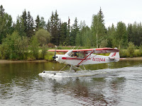
While on the tour a water plane took off very near us.  These water planes play an important role in transportation of Fairbanks residents and provisions. 
As we traveled further down the river we came upon an Indian Fish Camp, where camp is set up with tents for housing, a smoke house is built, and a processing plant, so to speak, is built to clean, dry, and smoke salmon.  The supply of salmon harvested will last the entire winter for an Indian family.


An Indian girl was working the fish camp when we arrived.  She modeled her winter coat.  Would you like one like this?


The Discovery trip also provided some photo moments of animals. Check out the bold and majestic eagle below. He was perched at the top of a fur tree as if supervising his territory.


Another attraction – The University of Alaska Museum of the North is known to be one of the best museums in the state.  While there, a lady approached me and was thrilled to see my name tag, which states my name, hometown, and state.  She excitedly said, “Shelby, North Carolina!!!   We were students at the Ambassador Bible College in Lattimore.”  That really excited me.  That college in Lattimore is the building in which I attended Lattimore School for grades 5, 8 and 9.  WOW!  The lady and her husband live in Hawaii and are missionaries there.  They were in Alaska visiting their supporting churches.
 

The museum houses many relics of days gone by both for the Indian Nation as the early settlers who came to Fairbanks seeking gold.  Below is one of many beautiful Indian relics on display. 

The University of Alaska is impressive.  It is a land-grant, sea-grant, and space-grant institution. You’d better believe that big bucks are provided to this university.  Below is a picture of reindeer that are housed on the campus.


Throughout our travels we’ve seen several animals in the wild and some actually on the highways.  But we had not seen a moose until we were in Fairbanks.  About 60 miles out in the Borough, we traveled a road that was known for moose sightings.  We saw a moose cow and calf feeding in the green grasses in the middle of a flowing creek.  This was a great find!


The night before we left Fairbanks, ten of our caravaners met for a meal together at Chena’s Alaskan Grill, located on the Chena River.  Finally some great halibut!

Friends from Texas, Florida, New York, and Montana

Friday, July 24, 2015

Chicken, AK


Tuesday, July 14 the Top of the World Highway took us to Chicken, a small frontier town in the late 1800’s, which has maintained that frontier charm over the years by choice. Early miners in 1886 wanted to name the town ptarmigan, but were unable to spell it so they settled instead for “Chicken,” which is the name in the North for ptarmigan.  As a result of this choice, Chicken, AK is the place to find various chicken items. 

Chicken remains a gold-mining town where most of the gold items for sale are locally mined at the 40 Mile Mining District, of which Chicken is the center. 
Dredge  for Gold in Chicken
Chicken is also well-known as the home of the late Anne Hobbs Purdy, whose story is told in her book, Tisha.  Ann came to Chicken at the age of 19 from Kansas and was determined to teach in the little town of Chicken.  She endured many obstacles but nothing made her give up and quit. Her dedication to teach all children, both white and Indian, drove her to extreme sacrifice. Her popularity fell and she became an outcast, but she never wavered from her decision.  Tisha is a book all teachers should read. 
The building in the background is a picture of the school.
Small businesses provide plenty of entertainment, food, and lodging for many tourists who travel through the town on the Top of the World Highway.  Enjoy some pictures below:


Our two-day visit to Chicken was enjoyable but we were without some of our expected conveniences such as WI-FI, water, sewage, power and paved roads.  But we managed to survive and were ready to leave on July 16.
Sunset in Chicken  AK at 2:00 AM
Land of the Mid-Night Sun
On a sad note, while we were in Chicken, we received word that our dear friend and my high school classmate, Ron Wilson, passed away after an extended illness.  We grieved alone since we were 5,000+ miles away.  Ron was a special friend to many, a loving husband to his wife and classmate, Linda Lovelace Wilson, a great father to two sons, and a proud granddad to two beautiful grandchildren.  Ron will surely be missed.


Monday, July 20, 2015

Top of the World Highway

The Top of the World Highway is really two highways, Yukon Highway 9 in Canada and the Taylor Highway in Alaska.  It is 175 miles long from the junction of the Taylor and Alaska Highway to Dawson City, Yukon.  The highway is open during the summer and becomes a snow-machine-only trek in the winter.
 
Four of our caravaners, including ourselves, had originally decided not to follow the other caravaners across the Top of the World Highway.  Some reasons include fear of damage to the motorhome, fear of the road conditions, fear of the weather conditions, etc.  All the fears were based on the responses of other travelers and the reputation the highway has acquired.  Well, one by one, all four of us decided we would go across the highway.  The alternative was to go back 700 miles the way we had come and those roads were not really good either. So taking the Top of the World Highway was the best choice to travel to Chicken, AK.  Buck and I decided we didn’t want to be the only “chickens” to go to Chicken.  So here we go.

Tuesday, July 14 at 5:00 AM we crossed the Yukon River on a ferry, the George Black Ferry.  All tow vehicles had to drive on the ferry separated from their motorhomes.  So I drove the truck and was taken over with another motorhome and some cars.  Buck drove onto the ferry later in our motorhome.  Another motorhome was also loaded with him.  When the ferry reached the shore, we were on the Top of the World Highway.  See pictures below.

Buck driving onto ferry.

Ferry Crossing.
Entering the Top of the World Road
Once we were both on the highway, we connected the truck to our motorhome and off we went.  We were told to expect animals along the road or even in the road.  So we had the camera ready.  Not even 1 mile from the ferry exit we saw animals on the road in the distance.  I grabbed the camera and was ready for some great pictures.  Well, guess what we saw!  Three baby coyotes were playing in the road.  Two of them ran after seeing us, but one seemed to enjoy the attention.  He sat and posed for our picture.  We even had to blow the horn to get him to leave the road.  As he did, we saw two additional pups over the ledge.  So the litter was 5 pups, for sure.  Like I haven’t seen a coyote before, here he is! 


The Top of the World Highway didn’t seem so bad.  There were sections that were paved, then sections followed that were completely dirt.  At first the road seemed wide enough, but as we continued, the road narrowed.  There were some steep inclines, hairpin curves, and muddy roads.  It had rained during the night in some sections.  We dealt with fog for a while; we couldn’t see more than two or three feet in front of us.  But later the fog lifted and we saw some beautiful views.  Below are pictures of our trip as we traveled the Top of the Road Highway.


On the Canadian section of the highway we did not meet a single vehicle.  That’s because the Alaska/Canadian border doesn’t open until 8:00 AM.  Once we crossed the border we began to meet some vehicles.  Most of the time there was space to meet, other times we pulled to the right as much as possible and then stopped to let the vehicle pass. Here’s pictures of the border crossing and our GPS Message that appeared soon after the crossing. 


If you can't read the message on the GPS, it states. "No legal route could be found!  Either there is no road connection available between your origin and destination, or your settings for weight, height, etc. in RV info need to be changed." Even that message was a little frightening!  

We had a friend take a picture of me in our truck after I crossed the ferry.  Compare the look of the truck before traveling the highway with the way our truck looked when we arrived in Chicken.


We're glad we traveled over the Top of the World Highway.  Our visit to Chicken was an interesting one.  Look for that blog soon!


Saturday, July 18, 2015

Onward to Dawson City, Yukon Territory, CA

As we left Skagway, AK on July 8 we crossed into Canada.  This was our second of three border crossings.  We had forgotten to remove a few items of produce from our fridge before we left. So when the officer asked us about produce, we told him what we had.  He just shrugged and let us cross into Canada.  Of course, he asked us about weapons, drugs, etc. but that little bit of lettuce, bell pepper, and tomato didn’t seem to bother him.  Guess we’re getting a little braver, but it’s still scary because of the horrible stories we’ve heard from others as they’ve crossed.

We retraced our route to Whitehorse, YT and stopped in Carmacks, YT for one night after 218 miles of travel.  Once we arrived, a thunderstorm hit the area, but that didn’t stop our Wagon Masters from working as they normally do – directing all 21 rigs into their assigned sites. 


Next morning, we left for our destination, Dawson City, YT, another 218 miles away.  Road construction signs were very common on this journey.  
We traveled for miles on dirt roads which were bumpy and dusty.

A fur trapper and part-time prospector, Robert Henderson, found gold in Rabbit Creek (now Bonanza Creek) in 1894, not far from where the Klondike River empties into the Yukon. (The word “Klondike” is English for the Indian tribe, “Tr’ondek.”)  Henderson told his friend, George Carmack, about his discovery.  In 1896, Carmack, along with two friends who were native companions, discovered gold on Bonanza Creek in 1896.  Carmack registered the discovery claim and within days, Bonanza and Eldorado Creeks had been staked from end to end by thousands of prospectors.  Carmack never told Henderson who missed out on the richest claims.

Thirty thousand pick-and-shovel miners, prospectors, storekeepers, saloon keepers, bankers, gamblers, prostitutes, and con men from every corner of the continent poured through snow-choked mountain passes and down the Yukon River to stake their claim to fortune on creeks with names like Eldorado, Bonanzo, Last Chance, and Too Much Gold. 
A dredge digs out stream beds and takes the gold from the rocks,
then throws the rocks out as waste.

Most settlers found no gold at all.  But the prospect of sudden riches was not all that mattered.  For many of those who made the incredible journey, the Klondike represented escape from a boring life and the adventure of a new frontier.  Thus, the town grew.  On the flats of two riverbanks, Dawson was a city of trampled mud streets, saloons, churches, gambling houses, and theatrical shows.  Beautiful boats, part of a fleet of 250 paddle-wheelers, ran the Yukon River, bringing in freight, new frontier settlers, and a new life for many.

The Han people (American Indians) had inhabited the land around the Yukon River for several thousand years and were the natives most affected by the Klondike Gold Rush.  They still live in Dawson City where the tribe operates the native cultural center.
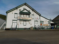
Dawson City has chosen to keep the traditional wooden walkways and dirt roads, except for “Front Street,” which is paved.  The buildings retain their original structure with at times, a new coat of paint.  Below are pictures of downtown Dawson City:
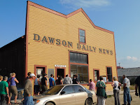
Dawson Daily News
Front Street businesses
Beautiful flower beds in Dawson City

             
Hotel, Restaurant, and Lounge

Houses in Dawson City
Diamond Tooth Gerties Casion, Saloon, and Theater


As the Northern Exposure Caravan was being planned, we learned that a few SMART members chose not to drive across “The Top of the World Highway.”  This road is known for its rough washboard dirt roads, steep inclines, and 11% grades with no side rails, etc.  Four SMART members chose to retrace the route -700 miles - to avoid this terrifying road.  Well, look for the next blog to find out what happens as our caravan leaves Dawson City, YT.